

Winter 2018

10 12, 2018

Beautiful Buffalo River Action Committee (BBRAC) Meeting (11/13/18)

By |2019-06-03T12:09:04-05:00December 10th, 2018|Categories: Pack & Paddle, Winter 2018|

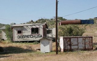
At a recent BBRAC meeting in Little Rock, several agencies reported some action. The Health Department reported on a small survey of septic systems in Newton County, and the Geology Department has stunning new relief maps of the watershed. But the most important meeting announcements were by Mark Faust, the new Superintendent of the Buffalo National River, and Billy Justus of the Little Rock office of the United States Geological Survey (USGS). Faust announced a “Buffalo River Science Symposium” scheduled for April 23-24 at the Durand Center in Harrison. The idea is to present as much science pertaining to the Buffalo River watershed as possible. This could be an opportunity to exchange ideas with researchers and regulators like the Arkansas Department of Environmental Quality and the Big Creek Research Extension Team and the many citizen advocacy groups like the Buffalo River Watershed Alliance, Ozark Society, etc. Justus made a presentation about microbial source testing on Mill Creek, which is notorious for years of pollution from non-functioning sewage treatment at Dog Patch, and also from cattle farms in the Crooked Creek drainage, which none-the-less contributes to Mill Creek because of karst. They are differentiating between poultry, humans and cattle, but not hogs [...]
10 12, 2018

Free-flowing Rivers Versus Dams

By |2019-06-03T12:09:37-05:00December 10th, 2018|Categories: Pack & Paddle, Winter 2018|

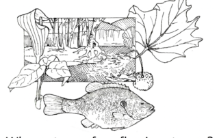
Many of us think of rivers and streams as fixed geographic features.  In fact, stream channels and the ecosystems that go with them are dynamic parts of our landscape that depend on a delicate equilibrium of natural forces.  Streams are characterized by a channel and surrounding alluvial flood plain that represent the geomorphic process of erosion and sediment transport. This channel structure results from an ongoing state of adjustment where local reaches of the stream are intimately interconnected with each other. A local change to the stream as seemingly inconsequential as occasional access for off road vehicles can affect the stream over large distances both up and down stream.  And it’s not just the structure of the stream itself.  The surrounding ecosystem depends upon the processes that create the stream environment.  Trees such as sycamore, box elder, and sweetgum are adapted to use exposed gravel bars as seedbeds.  Some of our favorite wildflowers require the rich soil of regularly refreshed alluvial soils that result from infrequent overflows during flood events. Dams, of course, represent an extreme alteration of the stream environment with especially severe consequences for the entire river corridor.  The body of stagnant water held by the dam causes the [...]

10 12, 2018

High-Pointing the States: Part Four – The Southeast Corner

By |2019-06-03T12:09:44-05:00December 10th, 2018|Categories: Pack & Paddle, Winter 2018|

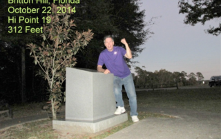
This is the fourth in a series of my adventure to visit as many of the fifty US states' highest points as I can. This time it's the southeast corner of the US: Florida, Alabama and Georgia. I did this trip a few days before my 40th High School reunion in Franklin, Tennessee, in October of 2014. Florida At only 345 feet, Britton Hill, Florida is the lowest high point in the country. The hill is located just off US Hwy. 331 near Florala, Alabama. It also tops the highest point in the peninsula, Sugar Loaf, by 33 feet. I started my trip early on October 22nd, hoping to get from Little Rock to the high point before dark. I went down to Hattiesburg, Mississippi and then went east toward Montgomery and then south on Hwy. 331. I took this route to see this area for the first time. I reached Florala just before dusk. Florala is a resort and retirement area about 90 minutes north of Panama City, that has a small lake and an Alabama State Park. I took a city street east out of town to a county road that would take me the 5 miles or so [...]

Go to Top