This is the fourth in a series of my adventure to visit as many of the fifty US states’ highest points as I can. This time it’s the southeast corner of the US: Florida, Alabama and Georgia. I did this trip a few days before my 40th High School reunion in Franklin, Tennessee, in October of 2014.
Florida
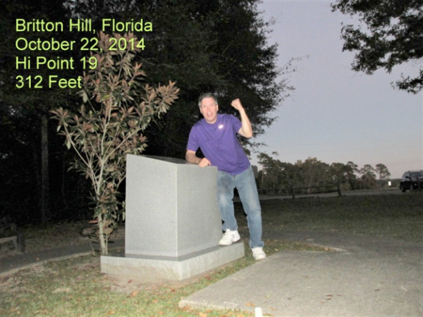
At only 345 feet, Britton Hill, Florida is the lowest high point in the country. The hill is located just off US Hwy. 331 near Florala, Alabama. It also tops the highest point in the peninsula, Sugar Loaf, by 33 feet.
I started my trip early on October 22nd, hoping to get from Little Rock to the high point before dark. I went down to Hattiesburg, Mississippi and then went east toward Montgomery and then south on Hwy. 331. I took this route to see this area for the first time. I reached Florala just before dusk.
Florala is a resort and retirement area about 90 minutes north of Panama City, that has a small lake and an Alabama State Park. I took a city street east out of town to a county road that would take me the 5 miles or so to the high point, just south of the state line.
The monument is located in a county park and is well kept. There is a monument stone and a registry. Other than that it looks like any other city park. I pulled into the parking lot and walked the few feet over to the marker to take photos. It was nearing 7 pm and I had been on the road for 12 hours, but I was feeling fine after dinner and drove on to Montgomery to spend the night. Florida was my 19th high point.
Alabama
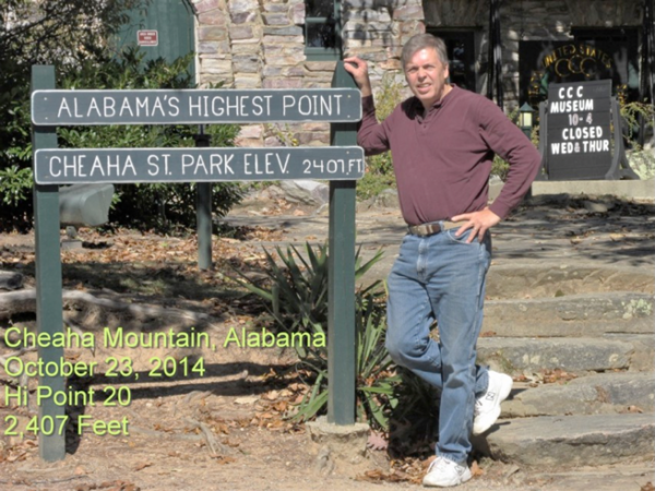
I got up refreshed in Montgomery, October 23rd, just a couple hours from my next goal, Mt. Cheaha, Alabama. I drove northeast from Montgomery towards the state park near Talladega. What a difference a day makes! Mt. Cheaha has an official elevation of 2,116 feet. The State Park is similar to Mt. Magazine, it has camping, a hotel and cabins nearby.
A tower structure occupies a spot next to the marker. It was closed the day I visited.
It may be much higher than Florida’s, but it is just as accessible. You can drive and park right next to the marker, taking a short walk over to nab a photo. The park is near the end of Appalachian Chain and there is talk of extending the Appalachian Trail over to the park. It was just past lunch, so I headed to Atlanta to visit some friends that night, before heading on to Georgia’s high point. Alabama was my 20th high point.
Georgia
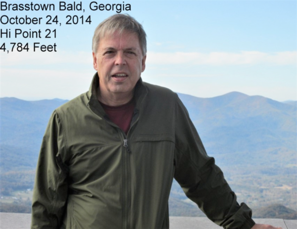
I had a wonderful time in Atlanta and I waited for rush hour to get out of the way that morning before making my way north to Brasstown Bald, Georgia’s high point at 4,784 feet. Brasstown Bald is in far northeastern Georgia, not far from the western point of South Carolina. It took about 3 hours from Atlanta to make it up to the park that has the peak.
Like Tennessee, Georgia has constructed an observation tower on the high point along with a lot of communication antennas. You park your car and a shuttle bus takes you to the top or you can walk up to the tower.
The actual marker is located in a locked room under a set of stairs. You can ask to see it and they will open the door for a photo. The mountain is in the southern portion of the Blue Ridge range of the Appalachians. Georgia was my 21st high point.
As beautiful as it was, I still had a stop in Chattanooga to make for dinner and then on to Franklin for the Homecoming game that night. Whew, three long days on the road, but I had put three more high points on my list.
My next episode will cover a group of states I visited in August of 2017, following the eclipse: Iowa, Minnesota, Michigan, Wisconsin and Illinois.