The Schoolcraft Chapter in the Springfield Missouri is reviving!
The group takes its name from Henry Rowe Schoolcraft, who traveled through the Ozarks for three months in the winter of 1818-1819 and left behind a detailed description of the region’s rivers, forests and wildlife. He described one Ozark river as “enchanting” and possessing the “purity of crystal,” and wrote that he could see every pebble, rock and fish in it “with the most perfect accuracy,” adding, “Our canoe often seemed as if suspended in air, such is the remarkable transparency of the water.”
The Schoolcraft Chapter during the 1970s and 1980s was a voice involved in the management of public lands and for protecting parts of the Mark Twain National Forest as wilderness areas.
Today we continue to fight to keep Ozarks rivers and streams clean and clear, our forests abundant, and access to these natural wonders.
Past Schoolcraft chapter chairman Loring Bullard has compiled the following list of a dozen adventures in the Missouri Ozarks. We think that whether you’re just getting started on exploring the Ozarks Outdoors, or have been knocking around the Ozarks for years, you’ll find a few gems on this list.

Loring Bullard
Local author
and
long-time Ozark Society member
offers his
Top Dozen Picks
of
Favorite Nature Spots
near Springfield
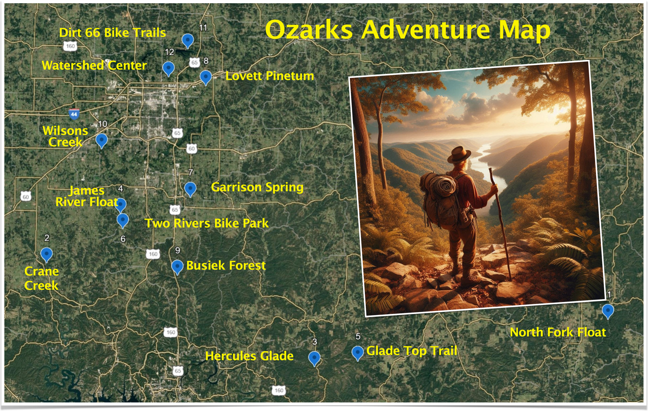
- North Fork River Float: The North Fork is a beautiful Ozark stream about two hours east of Springfield. Largely spring-fed, the North Fork is almost always floatable below Hebron Access. I like the section from Hebron to North Fork Campground (Highway CC) for overnight camping, since there are many large gravel bars and deep fishing and swimming holes. This section is entirely within the National Forest, so there are no houses along the river. Below North Fork Campground, the river is lined with private properties, and good campsites, away from houses or cabins, are rare. In May 2017, a huge flood took out the high bridge on Highway CC, which has since been rebuilt.

- Crane Creek Fly Fishing: Crane Creek is a small, spring-fed tributary of the James River in Stone County. About eight miles of upper Crane Creek has been designated as a Blue-Ribbon Trout Fishery, where only flies or artificial lures can be used. Crane Creek is one of the few streams in Missouri with a naturally reproducing population of rainbow trout, in this case the McCloud River strain of the redband rainbow, introduced into the creek in the late 1880s. Trout in Crane Creek are very “spooky” and wild, so stealth is mandatory. Also know that studies have shown a healthy population of water moccasins live along Crane Creek, hibernating in rocky, south-facing outcrops. Parking is available at the Wire Road Conservation Area.

- Hercules Glades Wilderness Hike: This 12,400-acre wilderness area was Missouri’s first, designated in 1976. It lies off Highway 125 about two hours southeast of Springfield and contains about 31 miles of trails. Ridgetop trails pass through open glades, providing outstanding views of the surrounding hills. The hike down to Long Creek is rocky, but the rewards are great. Long Creek flows through a shut-in area, with waterfalls and a limestone “grotto.” The old Hercules fire tower, 100 feet tall, still stands in the main parking area, near eight primitive campsites. Trail maps are available at usfs.gov., the Hercules Glades Wilderness Trail

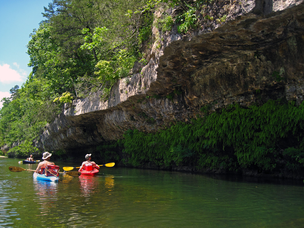
- James River Float Trip: Many sections of the James River that are floatable year-round, but my favorite is the six-mile stretch from Shelvin Rock to Hootentown, both Missouri Department of Conservation accesses. There are deep holes and scenic bluffs on this section, and exciting smallmouth action in spring and summer. I have even caught smallmouth here in January! This section also features one of the more exciting riffles on the river, just above the confluence of the James River with the Finley.

- Glade Top Trail: The Glade Top National Forest Scenic Byway is mostly gravel, curving twenty-three miles through some of the most scenic landscapes of southern Missouri, almost all within the Mark Twain National Forest. The road alignment has changed little from the time it was first laid out by the Civilian Conservation Corps in the late 1930s. The serpentine road mostly follows ridgetops, and pullouts provide outstanding views of the valleys, five hundred vertical feet below. The trail is heavily traveled in the fall, when colors can be spectacular, but consider driving it in spring, when hundreds of American smoke trees dot the hillsides. Glade Top Trail Maps can be accessed through the Forest Service website, fs.usda.gov

- Two Rivers Mountain Bike Park. This 400-acre private bike park is located at 5055 Two Rivers Rd., Highlandville, just south of the confluence of the James River with Finley Creek. The park features 14 miles of multi-purpose trails, with routes available for all skill levels. The park also has picnic areas and other recreational offerings
- Garrison Spring Community Forest. This 10-acre site, at 1699 E. Jackson Street in Ozark, Missouri, was recently purchased by the city of Ozark for a city park. Garrison Spring flows over moss draped ledges in a beautiful valley on the east side of Ozark. The spring was once piped to the Ozark railroad depot for locomotive water. The city has developed both wood chip and hard surface trails. Water flowing from the spring first passes through Garrison Cave, the seventh longest cave in the state, containing the endangered bristly cave crayfish. The cave is on private property and is inaccessible to the public

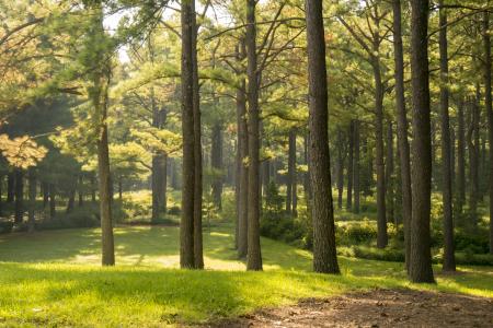
- Lovett Pinetum: Bob Lovett was a friend who loved and collected pine trees. His pinetum, an educational arboretum featuring over fifty species of pines (mostly from North America), is at 2706 N. Pearson Valley Rd., Strafford, Mo., 65757. Wood chip trails wind through the 108-acre site, passing by two large springs. A stroll through the whispering pines near Danforth Spring is very relaxing. Individuals and small groups my visit the pinetum by appointment, registering through lovettpinetum.org
- Busiek State Forest and Wildlife Area: About twenty miles south of Springfield on U.S. 65 Highway, Busiek surrounds Woods Fork Creek, a clear, spring-fed tributary of Bull Creek. This 2,700-acre area has two trail systems, with a total of 18 miles, for hiking and horse riding. The topography is relatively rugged, with elevations ranging from 980 feet at creek level to 1,200 feet along ridgelines. Trails cross Woods Fork Creek, a perennial stream, so if hiking you can expect to get your feet wet
- Wilsons Creek National Battlefield: Although the park at 5242 S. Highway ZZ, Republic, mostly commemorates the Civil War battle, the five-mile paved loop road has a walking and biking lane, crossing Wilsons Creek twice. Wilsons Creek, which receives the treated wastewater from the city of Springfield, is today clear and clean. The park also has five walking trails, from one-fourth to three-fourth miles long, accessible from parking areas.
- Dirt 66: Fellows Lake Bike Trails: There are over twenty-five miles of interconnected trails around Fellows Lake, one of Springfield’s drinking water reservoirs about five miles north of Springfield. Trails are available for single-track biking and hiking. Maps of the trail system are available from Ozark Greenways at ozarkgreenways.org.

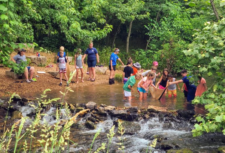
- Watershed Center: I have a special affinity for this site, located at 2400 E. Valley Water Mill Road north of Springfield, because I helped to get it built. The 100-acre site contains the main Watershed Center Building, a gold-certified LEED (Leadership in Energy and Environmental Design) education and demonstration center. The site has about 2.5 miles of walking trails passing through restored glades, upland forests, and over streams. The first dam forming Valley Water Mill Lake was built in the 19th century to provide a source of drinking water for the growing city of Springfield.


Of course, this is just a tiny sampling of what the Springfield Ozarks has to offer, there are adventures around every corner.