When I was 17, our family took a trip to the Smoky Mountains from our home in Nashville. While there, I happened to notice that the highest point in Tennessee was just down the road from our hotel. It was a beautiful summer’s day so we piled into the car and made our way to Clingmans Dome (6644 feet). Little did I know a lifetime hobby had begun.
We may have done at least one High Point of one state or another. Maybe you have been lucky to visit 5 or 10 high points as you passed by on your way to doing a trip to somewhere.
Then, there are people like me: High-Pointers, people who have a few points under their belt and want more. We are the folks who purposely plan trips so a state high point can be climbed. Sort of like Pokémon for hikers. I currently have 32 high points under my belt and I am planning to increase that number later this summer.
For me to cover my journey properly I am breaking the story into pieces and our Pack and Paddle Editor will print additional entries over the next few issues of Pack and Paddle. To get started, I am covering some of the states that touch Arkansas.
Arkansas
I moved to Arkansas in 1979 to take a job with the Highway Department. One Saturday my room-mate asks if I wanted to join a couple other friends and head over to Mt. Magazine (2753 feet) to do the highest point of Arkansas. OK, we were also going over to Wiederkehr to try out some wine, but I digress.
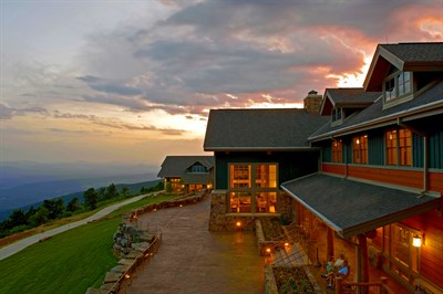
Not far from Wiederkehr is Mount Magazine. The ’79 trip was my first time up and since no one had a camera with us, I never had a record of my first time on top. I have since returned to Magazine several times over the years. My wife, Meribeth, and I returned when the new lodge was finished and by then the Youth Conservation Corps had improved the highest point by placing a map of the state in flagstone around the USGS elevation maker. What’s cool is the marker is on the stone map in the correct spot! The area was cleared, new summit trails were made from the lodge and the campground, benches were made and a sign-in board was installed. The area is now a source of pride as the mountain top looks like a big patio with informational boards.
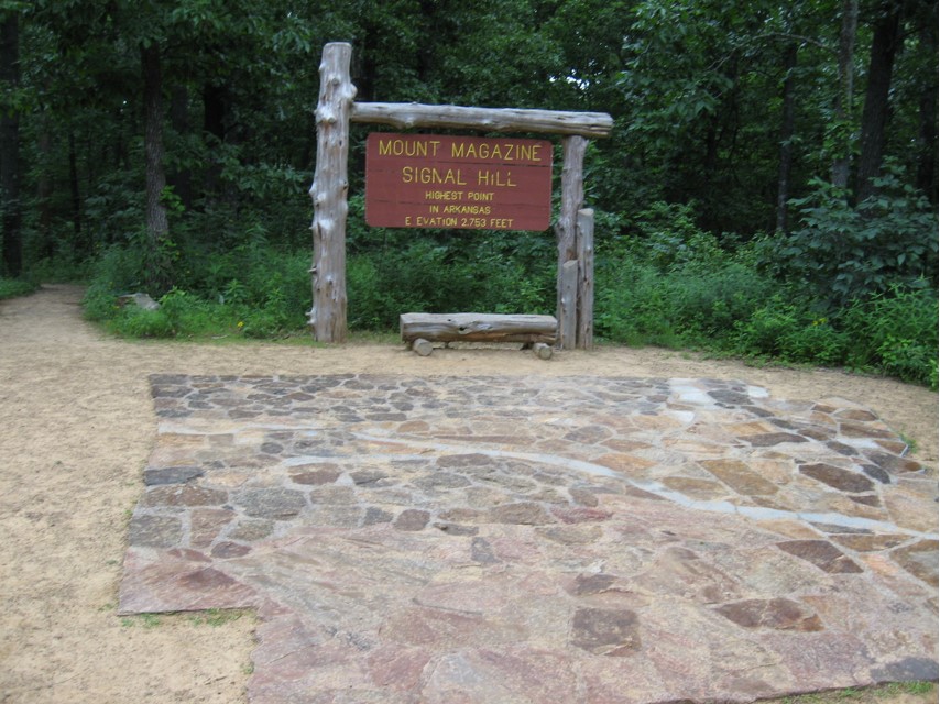
Magazine is a very easy summit. You can drive up to the lodge and take the trail from there or from the one from the campground. It’s about a 10 to 15-minute hike to the top and can be done by anyone who can walk. The lodge is a great feature for a state high point. And if you are expecting a view from the top, sorry, nothing but trees. Go back to the Lodge and enjoy the view there!
Tennessee
OK, back to 1973 and Clingmans Dome. This was the first time I had been to the highest point in any state. Clingmans Dome is outside of Pigeon Forge and makes a good half day trip for anyone in the area. You head east on Hwy. 441 and near the state line is the access road that takes you to the high point. Tennessee has built a visitor center at the parking lot and since it’s in the Great Smoky Mountains National Park, it is real busy in the Summer. From the visitor’s center you walk a very steep but paved path to the observation tower on the peak. Like the Arkansas high-point hike, it takes about 10 to 15 minutes to reach the top.
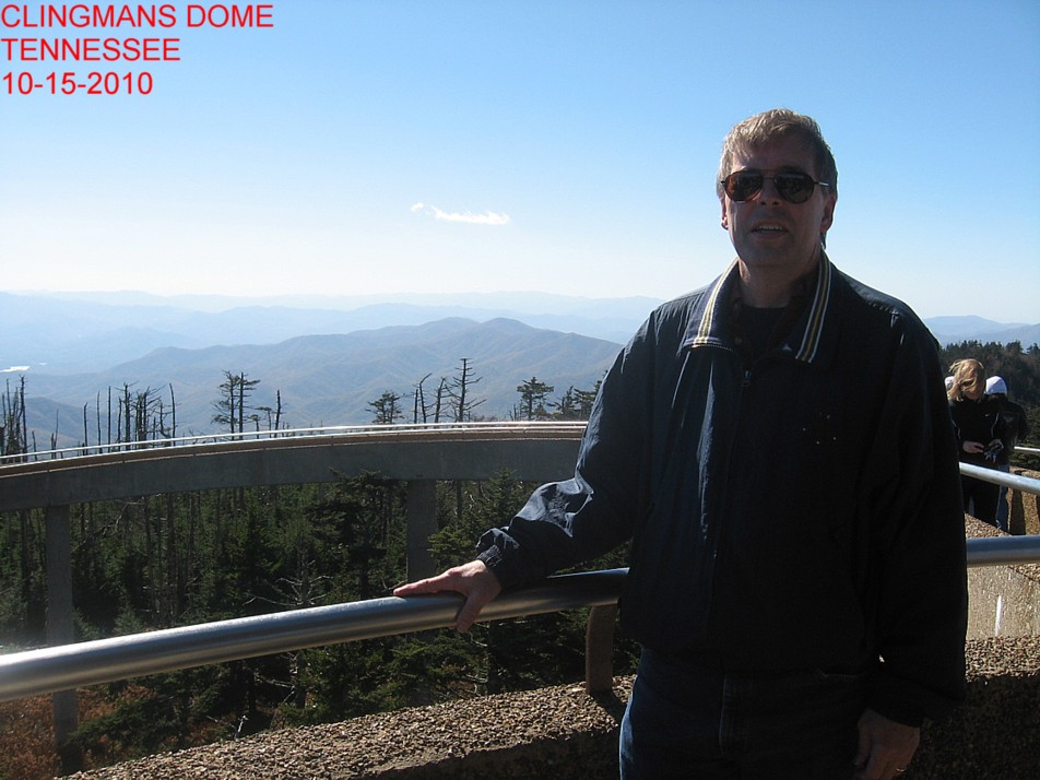
Meribeth and I returned to the summit back in 2010 on a trip to Ashville, N.C. This peak can be done by most folks, though the trail to the tower can be steep and hot for some as it’s in the open. The Appalachian Trail is not far off either if you want to check it out.
Missouri
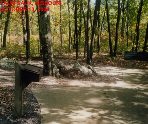
Missouri’s high point is call Taum Sauk (1772 feet). I know, only 1772 feet!
You would really think that Missouri had somewhere in the 2000-foot range. Like Arkansas, Taum Sauk is a state park.
The park is near the town of Ironton. This is a great place for white water on the St. Francis river. Unlike Magazine, this state park is camping only, but there are lots of great places to stay nearby. Go to Ironton and head southwest on Missouri 72 and follow the signs.
Taum Sauk was my fifth high point and I got it on October 13, 2006 when I joined the annual Gordon and Margaret Bartelt float trip down the Eleven Point. This high point is one of the easiest you can do. It is about a 200-foot walk from the car to the marker on a paved flat sidewalk. Like Magazine Missouri’s high point is not very scenic.
Oklahoma
Oklahoma’s highest point is called Black Mesa (4973 feet) and is in the very northwest corner of the Panhandle. I visited the site on August 1, 2014 while on a 5-state trip to see high points out west. (more on that trip in a later edition). The mesa is in New Mexico and Colorado as well. The point is near the town of Kenton and a great little state park is nearby for overnight camping. Nearest hotel is in Boise City. If you’re interested in breaking up that long drive to or from the Colorado trip, head to Boise City and follow the signs west to Kenton.
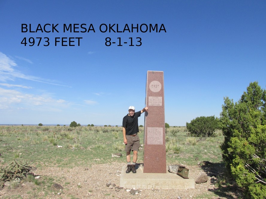
The Mesa was my 14th high point and sits about 800 feet above a side valley off the Cimarron River. From the parking lot it’s a flat hike up the valley for 3 miles or so before you make the climb to the top of the mesa. Once you make the top, you still have about a mile to go on flat trail to the marker. The marker is about a 15 feet tall piece of granite with carvings on all sides. There are a couple of benches to sit down on, but you are in the wide-open spaces of the high plains. The view is not bad from the top as you look into three states at once. Total hike is about 8.5 miles, so bring snacks and water. Don’t miss the three-state marker just about a mile from the parking lot.