By Steve Heye, Pulaski Chapter Outings Chair
California
In early 2020, I had organized a backpacking trip in the California Sierras that would include a day hike to the top of Mt. Whitney. Seven other folks had signed on and I had permits in hand for the trip to take place in early July. Then, in March, Covid came on the scene. Though we could have gone, everyone agreed that we would pass on the trip.
Twenty twenty-one looked much better. I still had the same plan: walk from Onion Valley to the John Muir Trail and I got the permits, we recruited four others to join us and everything was a go this time. We arrived in late July and started the hike after some acclimatizing. The guys did the hike and they had a great time. Meanwhile, I had to turn around the first day, suffering from what would be diagnosed as Rocky Mt. Spotted Fever. Bummer, turned back again.
As New Year’s 2022 rolled by, I wondered if I could do Whitney’s summit, then finish at Whitney Portal. I thought I was capable of doing this hike, so I proceeded for a third time to set up a trip to conquer Whitney and bag my forty-fifth high point. I knew there wouldn’t be as many folks in my circles that would be interested in joining me this time, so I kept the number of permits low at three. I also decided to approach the trip as a solo trip and I would modify it should a person or two come with me.
There were two ways I could try to approach the mountain. The first was a direct hike, using the Mt. Whitney trail to go up to the top and back to Whitney Portal, over three or four days. Twenty- two miles in all. This route, however, is known as the “impossible” permit. Only 20% of those who try for this permit get one, even though they give you 15 tries to get one.
The other way was to hike from Horseshoe Meadows by way of Cottonwood Pass. This route was 38 miles in length using the Pacific Crest Trail, John Muir Trail and the Mt. Whitney Trail to get to Whitney Portal. This way would be 5 or 6 days, almost all over 10,000 feet and a couple up and downs of 3000 -foot gain or loss. The permit for this second way was not hard to obtain and I could plan on being able to go this way if the other way fell through. I went ahead and got this trip’s permit in February and would drop it if the direct route permit came through in the lottery on April 1st.
April first came and no luck. All 15 permit requests were rejected, so I started planning my trip to leave from Cottonwood Pass.
The months passed and I continued to train for the trip, even with my neuralgia. I was having trouble getting an appointment to see a neurosurgeon. Finally in late June I was able to see Dr. John Day at UAMS. He said I had a classic case and surgery could take care of the problem. Five days later, I went under the knife and the result was excellent. No more pain, other than the wound behind my ear from the surgery. It was time to recover and restart training as I now had only seven weeks until the trip would have to start.
I continued to heal and train harder and soon the date to start the trip, August 21st, was here and it was time to go. I flew to Ontario, California early on the twenty first and got there just after noon pacific time. I got my rental car and drove to a near-by Walmart to pick up the items that I couldn’t carry on the plane.
I was going to use the town of Lone Pine as my base, just like last year. Lone Pine is a town of a couple thousand and is the gateway to Whitney Portal. The town is mostly famous for being the site for hundreds of movies, tv shows and commercials that are filmed in the Alabama Hills just west of town. Believe me when I say that you have seen this iconic scenery several times over the years. I got to Lone Pine about 6pm, checked into my motel and got dinner. After dinner I inspected my gear to see if anything was damaged in the flight. Nothing was out of order and I went to bed.
Friday, August 22nd, was a transition day. I finished packing my backpack that morning and after lunch I drove west out of Lone Pine on Whitney Portal Road to the campground 5500 feet higher, at the trail head where I would finish. I had reserved a site at the Portal Campground to spend the night to help acclimatize for the hike. The next day, my hike would begin from Cottonwood Pass, about 30 miles south.
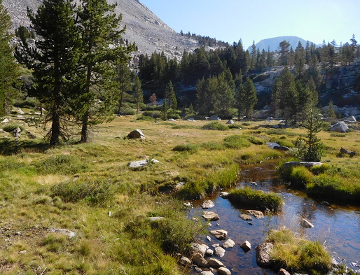
I arranged for a shuttle from the Portal over to Cottonwood Pass. I arrived at the trail head about 2pm that Saturday. I thanked the driver and loaded up to do a 4.5 mile hike up and over the pass to the Pacific Crest Trail. I walked just a bit farther to a place called Chicken Spring Lake for camp that night. The trails are well maintained for easy walking. Weather conditions were perfect: clear, calm winds and a star-filled sky. I decided to cowboy camp, no tent, for the night and went to bed. Turns out I would Cowboy Camp all but the last night on the trail.
Sunday was going to be my longest day on the trail. It was nearly 9.5 miles from Chicken Spring Lake down to Rocky Creek camp. There was a loss of altitude of over 2500 feet, to the lowest point on my hike at 9500 feet. It was a long day, almost 10 hours long. I was totally wasted by the time I lay down my camp next to the creek. I ate a quick dinner and hit the sack before it was dark. I slept nearly 9 hours.
I awoke refreshed, but then remembered that I would have to gain back 1700 feet of what I went down the day before. All of it right at the start. My goal for this Monday was Crabtree Meadow’s ranger cabin. The campground next to the ranger station is huge and it has a pit toilet! I slogged my way up the hill from Rocky Creek to Guyot Pass for most of the morning. It was a 7.2 mile walk this day. When I reached the lower Crabtree Meadow, I left the PCT and walked along Whitney Creek up to the campground at the junction with the John Muir Trail. I was feeling a bit better, as my body was adjusting to the altitude, the distance and the weight of my pack. Speaking of the pack, it weighed 45 lbs. when I started. It was only 32 lbs. when I left home. I can’t believe I added 13 pounds of stuff when I reached the trail head. Oh well, I was under 40 pounds by this point.
While at camp at the station, I visited with the ranger and got some information about the camping spots available above Guitar Lake. A lot of folks who do this route use the Guitar camps as the jumping off point for those going up to the Whitney spur and on to Trail Camp or back to Crabtree. I wanted to go farther up the trail from Guitar to cut down on the hike on Tuesday. When I got up for the hike on Tuesday, I decided to walk to a spot about a mile past Guitar where water was reported to be plentiful. After a hike of nearly 4 miles, I found a site that had lots of water and made camp. This would be my highest camp, at 12,000 feet. I knew tomorrow would be a long day and went to bed at sundown.
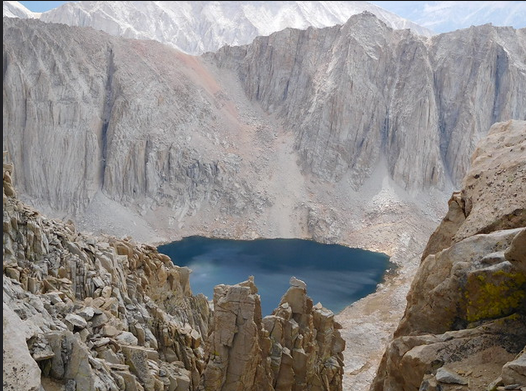
Today was the day. Finally, I’d have a crack at Mt. Whitney. I still had over 1200-foot climb with pack to the spur trail. It was also almost 3 miles away. I got up at 5:30am and was on my way by 6am. I knew what was ahead from the hikers ahead of me. Starting about 2:30am, there were folks headed past me and up the trail to see sunrise on top. You could lay in your bag and watch the lights weaving their way up the slope and on the spur. Three hours and eight switchbacks later, I reached the spur trail. I knew this is where I could drop my pack and day hike to the top of Whitney.
It was about 9:30am when I struck out for the almost two-mile hike along the ridge of peaks to the summit 1400 feet above me. It took nearly two hours to work my way to the top. As I came off the last switchback, there was the stone house built for research sitting ahead of me.
I had done it! Number 45 was in the books. I signed the register and took the obligatory photos, then sat down for a rest and lunch. Four days of hiking in the Sierras had paid off and the view was fantastic.
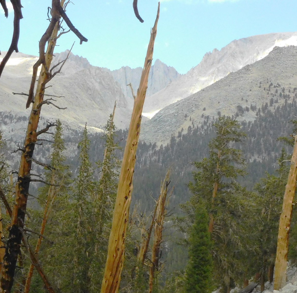
After an hour on the top and a few phone calls to family, I started back to my pack. I still had to go over the pass and then down the ninety-seven switchbacks to Trail camp. I got back to the main trail about 3 and loaded up for one last climb with pack on.
The climb was very steep and not much in the way of switchbacks, but I finally cleared the pass. And then it started to sleet. For the next hour while I was descending to Trail camp, the sleet pelted my hat and coat. Some of the rocks became slick from being wet, but 3 hours after picking up my pack, I reached my last campsite. It was a 12-hour day, but I was happy to have dinner knowing I had made it to the top.
Thursday, August 25th, was my last day on the trail. I still had 6 miles to go to reach Whitney Portal and lose nearly 3000 feet in altitude. It was a smooth decent over three benches and took about 6 hours. The weather had been perfect for nearly the whole trip other than the sleet the day before, then my luck ran out. Just 30 minutes from finishing, the skies opened up. Hail, hard rain, wind and lightning. Got that close, but I had to pull out my rain gear to finish.
The rain stopped just before I finished about 3pm and walked through the portal at trail’s end. I found my car, tossed in the gear, changed my clothes and headed down the hill to a dry warm motel.
There are 5 states left: Alaska, Montana, Oregon, Washington and Wyoming. What one is next? I know it’s not Alaska. Unless I’m flown to the top, Denali is not on my list. Rainier and Hood will require joining an outfitter’s group.
Wyoming and Montana are doable on your own, but going with an outfitter makes since due to the tough approaches. I’ll have all winter to figure out what’s next. Until then, I’m happy that I have now seen 90% of the list of state high points.
More photos of the trip can be found at the following link: https://flic.kr/s/aHBqjA6Bcg. I am looking for interested hikers that would join me this May or June on a guided hike on Mt. Hood, Oregon. Have them email me, heye@aristotle.net, if interested and get more info.