By David Peterson, Ozark Society Past President
Gravel bar migration:
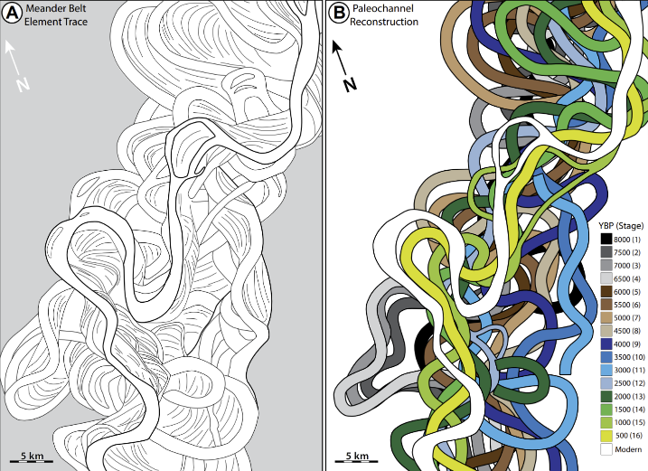
The Buffalo River and its tributaries are a dynamic system. Streambank erosion occurs on the outside of loops where the current is strongest and the debris is deposited on the inside of downstream curves where the current is less, hence gravel bar migration (see above, Calf Creek near Tyler Bend). Over time these loops expand, multiple bars can form, which eventually degrade and reforest when the river creates a new channel. Old channels and gravel bars can be seen everywhere in the Buffalo River flood plain when you walk away from the river. Upstream migration can also occur as bank cover and trees erode. On the right is a dramatic documentation of this process on the Mississippi over the last 8,000 years in 500-year increments. Each loop had its system of gravel bars which subsequently were degraded by the next flood or channel relocation. While basic physics governs these structures, over time specific future predictions are impossible.
If a historical study were made of the Buffalo River a similar map might occur except for local geography and scale: the river is smaller, the valley walls constrain the meanders, the gradient is much steeper, and the underlying geology (Boone Formation etc.) and erosion rate is different.
Mississippi Meanders
Flood rises are much steeper (52 feet in 1982) and of shorter duration, but the physics and long-term non- predictability remains the same. Migrating gravel bars are a nuisance to the United States Geological Survey (USGS) since they need to recalibrate their gauges as changes inevitably occur. Excessive gravel travels down channels making the river shallow.
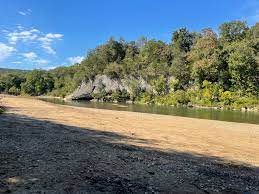
Buffalo River Gravel Bar
Climate change:
According to the USGS, stream flow increased 14% over the last 61 years, but there have not been corresponding significant increases in extreme events, making the role of climate change unclear. Burning of forest understory and fields, which increases runoff, was in use by indigenous people long before settlement began (1820), it continued during the heyday of logging (1880-1920), increased with clearing for pasture after 1920, and is doggedly pursued by the forest service today. Carbonate rock (limestone) and cleared land result in shallower channels, fewer pools, gravel substrata and eroding banks. But recent studies over the last 35 years show that the amount of gravel in the Buffalo, especially in the upper reaches, is declining.
Mussels:
Filter feeding mussels need clean running water and specific fish species to transport their parasitic larva to a new location. According to BNP biologist Shawn Hodges, “the Buffalo River may prove to be an important refuge for a declining mussel resource.” Mussel surveys on the Buffalo dating back to 1910 show relatively stable numbers and species (~25 compared to about 50 on the much larger White River). Possible threats are loss of necessary fish species and hydrological instability (eroding banks and shifting channels). The relative detrimental role of climate change verses other human intervention is not clear.
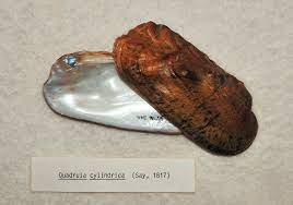
Rabbitsfoot Mussel
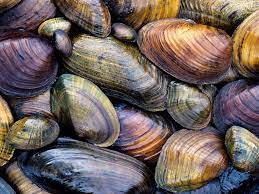
Fresh-water Mussels
If surveys indicated a possible extirpated species (e.g. endangered Rabbitsfoot mussel), artificial insemination and transportation of juveniles to suitable unpopulated bed sites might be a short term solution. How about stream bank restoration? Unlike the White River there are no dams on the Buffalo and after 50 years of protection as a national park, natural stream bank restoration is slowly occurring within the park. But 89% of the watershed is outside the park.
There has been growing support in state government and organizations like the Ozark Society for hard surface road building, fencing cows out of streams, septic tank improvement, bank stabilization on tributaries, as well as human waste control in the park. These efforts will need to continue as the nascent recreational property movement (an after effect of Covid), and commercial property development continues to spiral.