By David Peterson, OS Past President
I read the December 17, 2023 headline in the Arkansas Democrat Gazette, “U.S. Forest Service prepping impact statement for coal mine in Arkansas,” in partial disbelief. Ouro Mining Company in Fort Smith planned to mine 3.5 million tons of coal per year for 20 years, half from under the Ouachita National Forest (ONF) and half from old private leases in adjacent Oklahoma. Is this possible in a world which just passed the 1.5 C target for global warming?
In order to have standing in the ensuing permitting process the Ozark Society had until January 25, 2024 to submit comments.
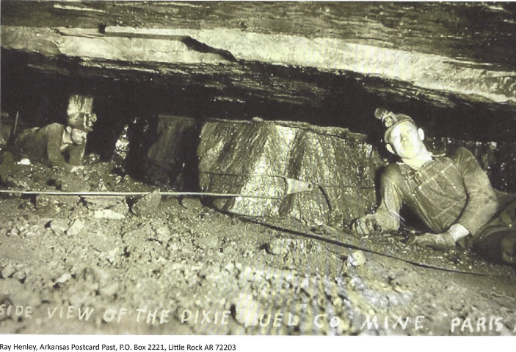
Miners in Paris, AR, 1930’s. Ray Hanley, AR Dem/Gaz
History: Coal mining in the western part of the Arkansas River Valley dates back to 1818, but the peak production year was 1909, followed by an erratic, long term downward production slide until the last mine closed in 2017. The mines were never very productive due to coal seams as narrow as two feet. Mining was extremely hazardous (in the 1930’s, 14 miners died in methane explosions at Bates, AR), there were miner strikes and violence in the 1910’s, the mines were not near prime steel mill customers in the north, nearby power plants eventually found cheaper coal from strip mines in Wyoming, and finally, climate change implied the demise of fossil fuels – the death knell for Arkansas coal, or so it seemed.
The Arkansas coal mining industry, like those throughout Appalachia, have the bad habit of declaring bankruptcy or just leaving town after mining is completed. There have been 157 expensive, government reclamations of old surface coal mines in Arkansas. There is no evidence of reclamations of underground mines, which would seem to be much more difficult. Rule Number 20 (Arkansas Pollution Control and Ecology Commission guidelines for surface reclamation) runs for hundreds of pages, but there is no rule for underground reclamation.
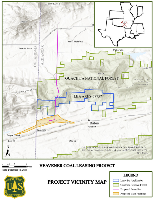
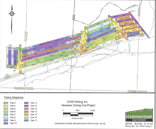
The mining proposal: About half the Ouro mine would be under 3077 acres in the ONF (center blue area in the map), and half from Oklahoma immediately to the west (not depicted). The orange is a loading and processing area on private land. The red line piercing the ONF is a new power line with a 100 ft easement. The entire area north of Bates is pockmarked with strip mining ponds and slag heaps from previous surface mining. The 11,299-acre Poteau Mountain wilderness is 4 miles to the northeast of the proposed mine. The automated mining machines, 18 feet wide, will move underground, east from Oklahoma up a 12% grade, creating roomlike corridors through the coal and rock, leaving pillars of rock and bolts to hold up the roof. The ONF mine area is about 4 miles long (see map). Colors indicate active mining years. The company overview admits “Areas subject to underground mining will incur some subsidence, although existing land usage is possible after completion.”
Governance: The permitting system is confusing. Under the 1947 Mineral Leasing Act, the Bureau of Land Management is responsible for coal leasing and regulation, but they can reject an application if “leasing of the land … [means] environmental or other sufficient reasons, would be contrary to the public interest.” The BLM must have OFS consent before offering the lease for sale.
The 1970 National Environmental Policy Act (NEPA) requires an environmental study before an OFS decision. In this case, the OFS deemed themselves understaffed in making this coal decision and handed the process off to the Southern Regional Forester, which put it in the hands of its experts. There are many small steps to the process – the OS has taken its first step by submitting our comments before the January 25 deadline.
Ouro: Ouro seems to be a shell company of sorts. In 2014, The BLM accepted a lease application for this land from Emera Corporation, a Canadian conglomerate, in behalf of Ouro. Advertisements for workers appeared ($16-36/hr), but the application was withdrawn.
Ouro, is a subsidiary of a large Australian mining company, which is then owned by a very large private equity company. According to company reports in 2014, which included wonderful estimates of local economic and job impacts, the ensuing delay in the project was an issue of world economies, and coking stocks in target companies in China, India, Brazil – up to 10,000 miles away. Ultimately, if the mine opens but fails to return the land to its original use, where does the buck stop? The ONF, BLM other federal agencies?
Environmental Issues: Burning 70 million tons of coal over 20 years would generate 140 million tons of CO2 in a world battling climate change. Acid drainage from slag piles and surface processing, along with the massive underground mine disturbance, is a long-term control problem for area streams. There might be subsidence and sinkholes around vents. The mine is in an excess methane zone – with forced air venting or flaring into the forest. The 3-mile swath of electric line intrusion. 3.5 million tons of coal represents 87,000 coal truckloads per year, or 33,000 rail cars, resulting diesel fumes and spills, and more dust and road damage. Water table disruption may occur.
Economics: The Arkansas severance tax of 10 cents per ton (1947), with revenue split 25/75 between county and state, is entirely inadequate to keep up with road damage, and eventual reclamation. Mine production seems to be captive to the decreasing, and widely variable world market, suggesting that mine employment prospects on the application might be unrealistic.
Conclusion: There are no active mines in Arkansas now, and only one pending permit – this one. The OS submitted comments on time, calling for a much more detailed application which addresses our environmental concerns. The next step is the NEPA report from the national forest team – later this summer? Reference: Heavener Coal Leasing #64897
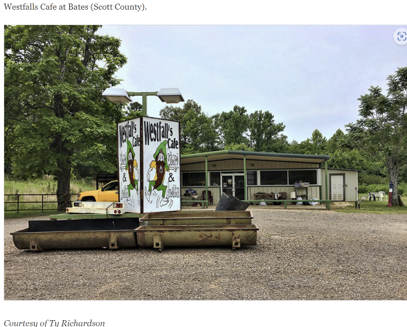
Just for fun I suggest a hiking trip to this area and eating at Westfall’s in Bates AR. See below.