This is the third in a series of my adventure to visit as many of the fifty US states’ highest points. We’ve visited the six states that surround Arkansas and Mt. Magazine in the previous two episodes. This time we’ll look at a trip I took in August of 2013 to visit 5 western states: Oklahoma, New Mexico, Colorado, Nebraska and Kansas.
Since I covered Oklahoma in part one, I’ll just say that it was the first stop on this trip. I left Little Rock and drove over 700 miles that day to the panhandle and stayed in a state park that was near Black Mesa. The following day I got up and did the Mesa before lunch then made my way from Kenton, Oklahoma west into New Mexico, heading for Taos.
New Mexico
It was interesting to drive the back county and state roads in N.E. New Mexico. The high plains gullies and scrub made for an eye-opening trip. I finally was on U.S. 64 to Cimarron to make a quick visit to the Philmont Scout Ranch on my way to Taos.
I arrived in Taos about 6 pm, ate dinner and decided to get closer to my target, Wheeler Peak, by driving up to the Taos Ski Area. The most direct trail for the mountain top leaves a parking lot at the base of the ski area. I rigged my car to sleep in the back and went to bed, ready for my 7.5-mile round trip to summit Wheeler Peak.
I got up about 6, had a quick breakfast and started up the trail as it went through the Ski Run. Above the run you’ll come to Williams Lake. Here you take a steep trail that goes across the western scree slope of Wheeler. A few long switchbacks and you make it to the trail that runs the ridge containing the peak. Another half mile or so and you are on top of the highest point in New Mexico, 13,161 feet.
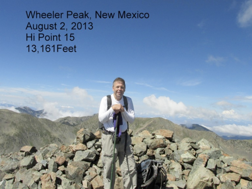
The view is very nice. To the west is Williams Lake and the Ski runs, to the north the peaks in Southern Colorado and to the east and south more of the mountains of the Sangre de Cristo. I had lunch on top and headed back to the car to start my way to Mt. Elbert in Colorado. Wheeler Peak was my 15th high point.
Colorado
It was the evening of August 2nd and I pulled into a KOA in Alamosa, Colorado just before dinner. I decided to stay at place that had a shower and WIFI tonight since I had been on the road for 3 long days and over 1000 miles. August 3rd would be a play day for me with a visit to the Great Sand Dunes and a leisurely trip up to the campground for my hike up Elbert on August 4th,. I had dinner in Leadville and got a sandwich for the next day’s hike.
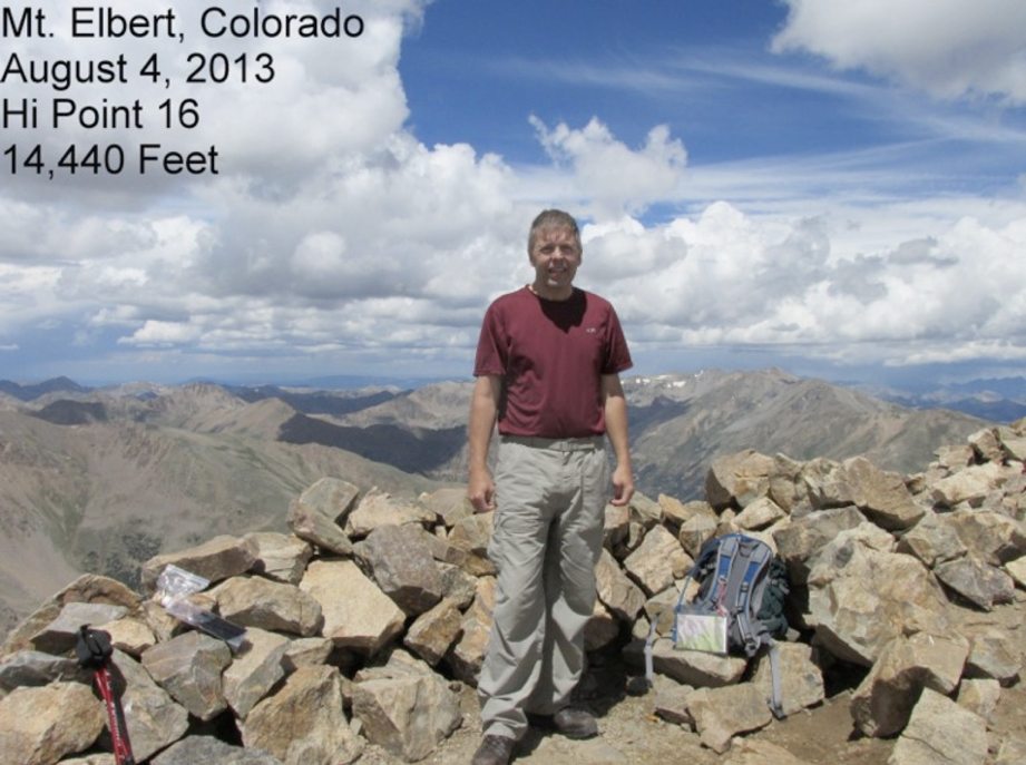
I spent the night in my car again at the North Mt. Elbert Trail head. From here I would have about a ten-mile round trip to the top of Elbert and back on the North Mt. Elbert Trail and the Colorado Trail. The elevation difference was roughly 4700 feet from the parking lot to the peak. At 14,440 feet, only Mt. Whitney in California is higher in the lower 48 than Mt. Elbert.
I left my car about 6 am on a star-filled morning, hoping to beat any afternoon storms while I was above the tree line. The trail is well used and maintained, but for some reason it was having the better of me. I reached the tree line about 9:30 having gone only about 3 miles, I could see my pace was way off. The next two miles were where the mountain threw everything it had at me. It would take me 4 hours to go those two miles, one to two hundred feet at a time. Mean ol’ Mr. Altitude had struck me.
The 3000-foot gain on Wheeler two days earlier had been a piece of cake, but for some reason I could not get my breath without stopping for 30 seconds every 150 feet. I am not used to being passed so much. The locals would smile and say an encouraging word as they skipped by and I slugged up the trail to the top.
Finally, at 1:30 pm, seven hours after I had left camp, I reached the summit of Elbert. Victory and lunch was mine! “KaaaaRACK!” I no more than sat down to eat when a storm over nearby Independence pass was headed our way. I got the pictures, grabbed my pack and sandwich and started back down the trail, this time with some incentive: Hail and lightning. I got back to the car about 4 pm and drove to my cousin’s house in Denver for the night. Mt. Elbert tried to stop me, but I bagged number 16!
Nebraska and Kansas
I spent the next day visiting my Colorado Cousins. Leaving Denver early on August 6th, to try and conquer both states in the same day. I headed north about 130 miles to the spot where Colorado, Wyoming and Nebraska come together. Nebraska’s high point is within a mile of this junction. I arrived just south of there in the town of Grover, Colorado for lunch at the only store/cafe in town. It was the best lunch I have ever eaten at a Post Office!
After lunch I drove north from town to visit the 3-state point first and then drive the couple of miles over to Panorama Point, Nebraska. The 3-state marker was my second on this trip, having visited the Oklahoma, Colorado & N. Mexico marker a few days earlier.
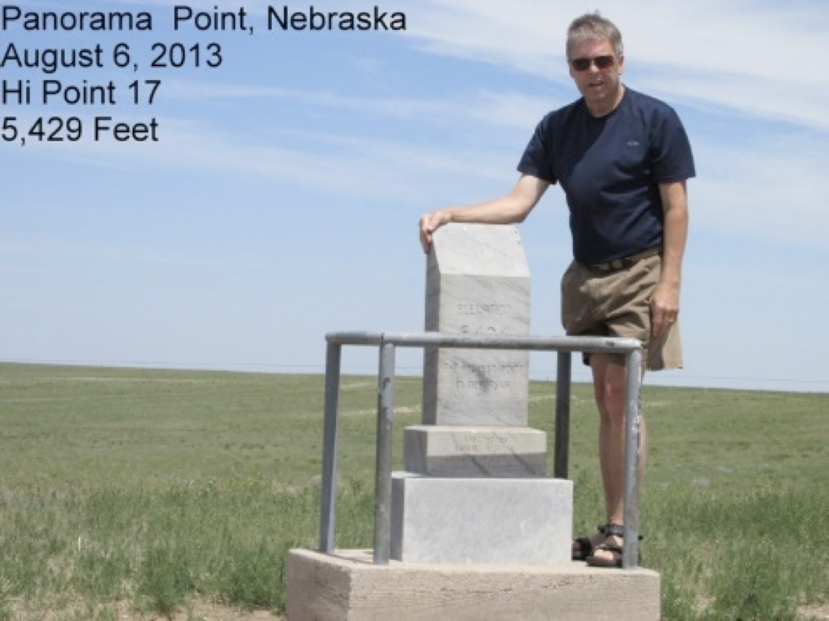
Nebraska’s high point is on a buffalo ranch and has one road in and out. You are asked for a donation to maintain the road and site. You drive up a small rise to the marker and sign-in board. From here you see the high plains in all directions. To the southwest at the bottom of the rise is the 3-state marker. Panorama Point is 5,429 feet above sea level and was high point number 17.
It was about 2 pm when I left for the Kansas’ high point, Mt. Sunflower, which lies about 250 miles to the south east. On my way through Colorado, I took a lot of back roads and saw a lot of the high plains that I had never seen. I also found my Aunt’s old home in Ft. Morgan as I passed through. It would take me about 4 hours to finally reach the second high point of the day.
Mt. Sunflower is located about 20 miles south of I-70 at the Colorado/Kansas line.
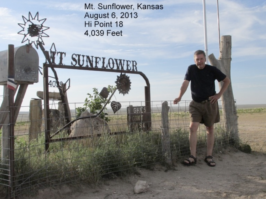
The route is well marked from the exit and it’s a series of roads on section lines to get there. Being flat Kansas, the state’s highest point is not a mountain at all, but a flat area just a mile from the State Line. At 4039 feet, Mt. Sunflower is an easy one to visit. You have only to drive up and get out of the car. I took the photos, signed the register and headed for Goodland, Kansas for a hot dinner and a motel having bagged my 18th high point.
So that’s the loop I call the Western Swing. All of these points are not that out of the way the next time you are driving to Colorado for the Society gathering or any other reason.