Long ago during the Coal Age the rugged Ozarks were the western coast of North America as rising and falling sea levels caused the scene to alternate between shallow tropical seas and coastal swampland. Continental drift had placed ancient Arkansas on the equator and the collision of land masses caused a great arc of rugged mountains to extend from eastern Canada around to become the ancestral Ouachita range. This collision had produced a single continuous land mass (Pangea) extending all the way over the south pole. That, in turn, caused great ice sheets to come and go, as driven by periodic shifts in the shape of the earth’s orbit – the same shifts that have caused ice sheets to come and go in our present Pleistocene era. With the gentle slope on the edge of our continent, river deltas extended back and forth between southern Illinois and central Arkansas as ice sheets expanded and contracted. All the while, the advancing continental collision and build-up of sediments derived from mountain ranges being created caused river deltas to extend ever farther into our area. The sandstone deposited by those deltas would become the backbone of the Boston Mountains we hike on today.
The world of that ancient delta was far different from the world we now know. The most common land fossils found in the Boston Mountains today are imprints of massive lepidodendron stems (literally tree trunks). This was a primitive, moss-like plant (a lycopod) that produced upright stems up to 100 feet tall bearing spore-producing “fruit”. Parts of these stems must have been carried like driftwood in river channels to be buried in sandbars during flood events. We see the scale-like imprints of leaf attachments arrayed in ordered rows on driftwood fossil trunks exposed in sandstone layers in outcrops. These coal age plants formed the thick fossilized peat layers being mined in the Appalachians today. Coal beds are sometimes 20 to 30 feet thick, and the empirical rule that there is a factor of ten compaction applied to generate coal gives an idea of how thick those original plant material deposits must have been.
Modern peat deposits are building up in the Florida Everglades and Irish fens today. The Boston Mountain delta swamps were far different from these for several reasons. The cause of the differences lies in the history of evolution. In Carboniferous times some 300 million years ago, plants had developed tough lignin fibers to strengthen their stems, but fungi had not yet found the ability to digest them. That accounts for the great thickness of coal deposits. But that also caused the carbon pried away from CO2 by photosynthesis to be taken out of the atmosphere. That left oxygen to accumulate in the air. Geoscientists estimate that oxygen comprised as much as 35% of the air breathed by Carbon Age life compared to 20% today. Primitive life on land then had the available energy to grow to prodigious size. There were scorpions the size of German shepherds and dragonflies as big as an albatross. The presence of large amounts of charcoal within coal shows that there was enough oxygen in the air to cause even swamps to burn. Ancient Arkansas was clearly a different place from what it is today. But exactly how big were the rivers that created the Boston Mountain delta? The answer lies in zircons, a crystal derived from zirconium, oxygen and silicon. The original crystals congeal within cooling magma of a volcanic intrusion created during mountain building.
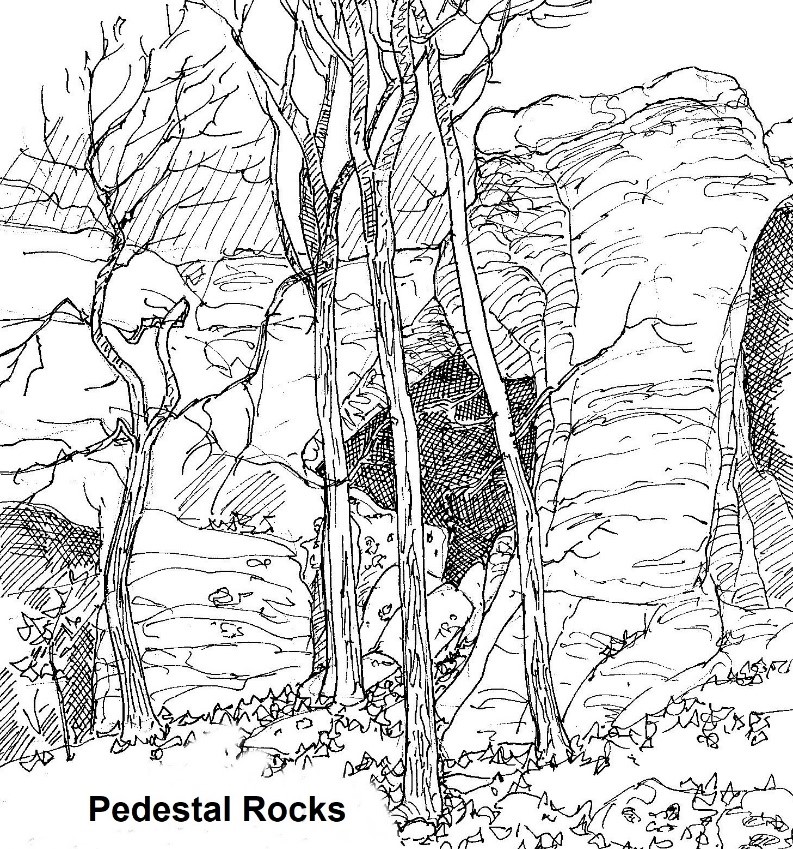
They then have two properties that make them useful to science: their formation excludes lead, and they become one of the hardest minerals known. They are so hard that they survive multiple cycles of erosion and deposition. The initial exclusion of lead means that their lead/uranium ratio can be calibrated to estimate their age because lead accumulates from the radioactive decay of uranium over the time after the crystals first formed. So, we can investigate the Boston Mountain sandstones by aging the zirconium grains they contain, and then looking for source areas that were erupting at that exact time. Analysis points to eastern Pennsylvania as a likely place of origin. This provides a scenario where rivers draining the high Appalachians along the eastern edge of North America were transporting mineral grains all the way to the southwestern shores of Arkansas. As you hike beside exposed sandstone walls eroded into that ancient delta look for the characteristic concave upward texture of beds (geologists call this crossbedding) laid down by powerful currents pushing mineral grains up and over the top of large underwater sand ripples so many years ago. When we hike on the lichen-encrusted ledges of the Boston Mountains at places like White Rock Mountain and Pedestal Rocks we are treading on the bed of an ancient Mississippi-sized river, but without ever having to worry about encountering German shepherd size scorpions or avoiding the flames of raging swamp fires.