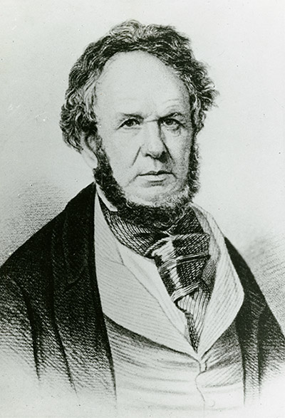
We want to thank Loring Bullard and Dan Chiles for all their efforts to revive the Schoolcraft Chapter of Springfield MO. It now has 23 members and counting. In honor of their work, Fred Paillet, OS Education Chair, has a story about Henry Schoolcraft, their namesake.
Fred’s Story:
The legacy of one of the earliest Ozark explorers is chronicled by a modern annotated edition of Henry Schoolcraft’s winter trip across the broad divide between the Missouri and Arkansas rivers in: Rude Pursuits and Rugged Peaks – Schoolcraft’s Ozark Journal 1818-1819, Henry R. Schoolcraft and Milton D. Rafferty, 1996, 170 p. The book contains the original journal with annotations and maps, plus a biographical sketch of Schoolcraft and his career. The journey takes about three months and was made in early winter (November through January).
The route is over the headwater tributaries of the Meramec River, across the headwaters of the Current River to follow down the North Fork of the White River. Then, down the White to the Black River, going up to cross over into the St. Francis River on the way back to the Meramec drainage. Rather mild weather at the beginning and streamflow so reduced that a few dry camps were unavoidable. Much of the countryside in the Meramec and Current headwaters is described as rough and barren.
Lots of descents into and out of steep ravines. Much of the landscape described as barrens with scrub oak. Extensive plains on the crest of the uplands. Here the description is definitive – a general resemblance to the prairies around Chicago, but with much less luxurious grass on account of the infertility of shallow soil, and the apparently level expanse interrupted by rough topography belied by the level-looking scene. Lots of bare exposed rock on promontories, with juniper at least mentioned as present in such locations. Open stands of yellow pine on uplands mentioned but not further described.
Schoolcraft is impressed by how poor the soil in these “plains” appears while noting the narrow but fertile corridors along stream bottoms. But the alluvial areas are tough going with nasty tangles of greenbrier and spicebush, and dense thickets of cane almost everywhere. He remarks pretty definitively that the 38th degree of latitude marks the northern limit of cane. Giant sycamores figure prominently in his description of rivers. Buffalo and elk are identified as present but most of the game is in the form of deer, bear, and vast flocks of turkey. The extreme clarity of streams and rivers is noted.
Schoolcraft is especially concerned with minerals but much of his description is hard to relate to modern usage. “Secondary limestone” apparently used to distinguish sedimentary from granitic basement. Not clear what he means by “spar” and “jasper” – perhaps some form of chert. Most of the oaks described correspond to modern usage but have to search to find that Quercus tinctoria noted as the most abundant tree on the Black River is now classified as black oak (Q velutina). At that early date it is interesting that there is so much settlement already on the lower White River, with those on the south side of the river being displaced as the land between the White and Arkansas was being designated for the Cherokee migrants being forced out of their eastern homeland. On the final leg of the trip Schoolcraft is greatly impressed by the granite boulders and cliffs in the bedrock core of the Ozark uplift. Makes the upper St. Francis River gorge a place for Ozark Society hikers to visit in the future.