-
 This patch has an adhesive back and can be ironed on or sewn on.
 -
 Represent the Ozark Society with this small metal pin!
 -

This beautiful color illustrated book provides a clear, concise way for children to identify Arkansas’s state butterfly, the Diana Fritillary, in its natural habitat by Lori A. Spencer. It features 28 color photographs, drawings, and other resources for children, parents, and social studies teachers.
-
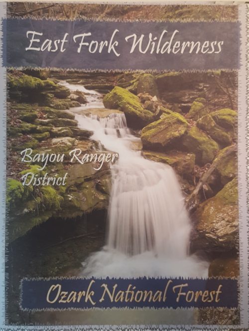
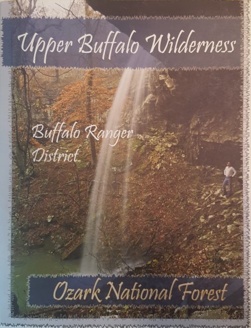 The Ozark Society, in cooperation with the U.S. Forest Service, has produced a series of new Arkansas Wilderness maps. These GPS friendly maps use UTM grids and the standard topo scale of 1:24,000. The Ozark Highland Trail and private inholdings are very clearly marked and valuable contact information and Leave No Trace camping tips are included. The maps feature the photography of Tim Ernst. For the first time, an entire wilderness area can be viewed on one map.
 -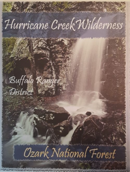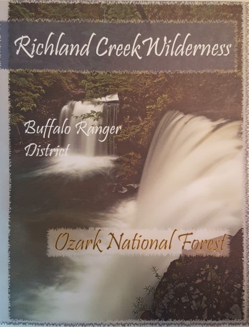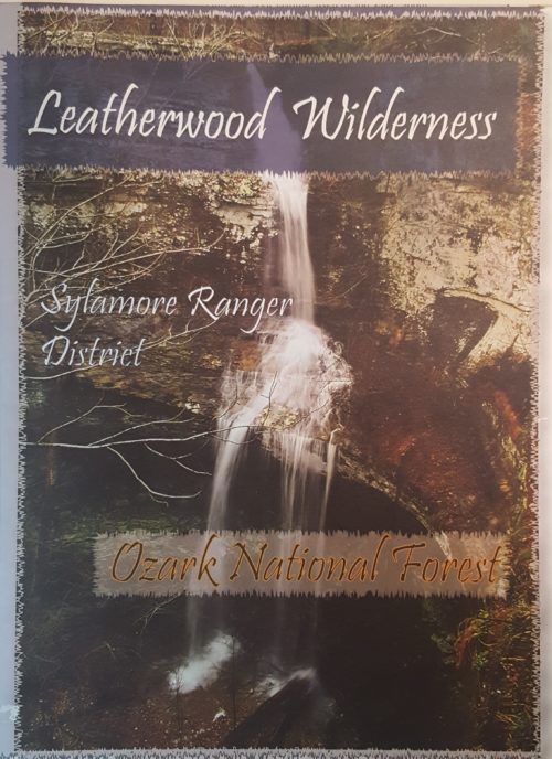
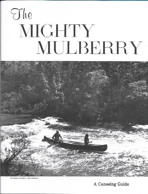 The Mighty Mulberry is a “nostalgia” item originally printed in 1974. It has wonderful photos of many of the Ozark Society founding members, including authors Harold and Margaret Hedges running Sacroiliac in their aluminum canoe. The center is one of the best maps of the Mulberry ever produced containing all of the rapids under their original names. This booklet has been faithfully reprinted on fresh, crisp print stock. Enjoy a new copy of this classic Ozark Society publication. Quantities limited. $10.00
 -
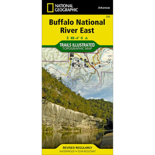
This map, first published by Trails Illustrated in 1992-93, uses USGS topographic maps as a base. T.I. has added hiking and horse trails, roads, campgrounds, and other features not shown on the 1960s vintage USGS maps. Also shown are routes of access to river and wilderness, and floaters’ car shuttle routes. Map users will find it easy to calculate the mileage of any trail hike or river trip and will see information for hikers, floaters, horseback riders, for anyone wanting to explore the Buffalo. The map is printed in four colors on waterproof, tear-proof plastic. Map design and text are by Ken Smith, author of Buffalo River Handbook and The Buffalo River Country, with cooperation from the National Park Service and U.S. Forest Service. This map includes the Leatherwood and Lower Buffalo Wilderness Areas. -
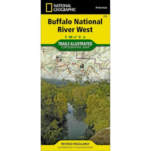
This map, first published by Trails Illustrated in 1992-93, uses USGS topographic maps as a base. T.I. has added hiking and horse trails, roads, campgrounds and other features not shown on the 1960s vintage USGS maps. The map includes routes of access to river and wilderness, and floaters’ car shuttle routes, and map users will find it easy to calculate the mileage of any trail hike or river trip. Included is a list of day hikes graded by difficulty and information for hikers, floaters, horseback riders, for anyone wanting to explore the Buffalo. This map is printed in four colors on waterproof, tear-proof plastic. Map design and text are by Ken Smith, author of Buffalo River Handbook and The Buffalo River Country, with cooperation from the National Park Service and U.S. Forest Service.