-
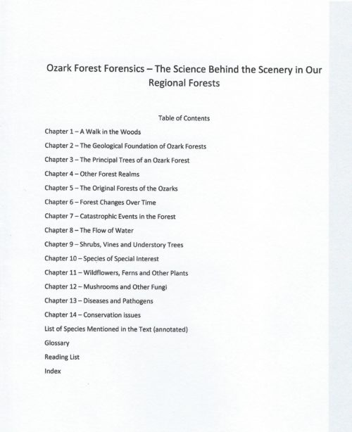
 This book interprets our natural surroundings in a way that enhances a simple walk in the scenic deciduous woodlands of the Ozark Mountain region. Explanations go beyond trees and their habitat to include other diverse subjects: the leaf litter beneath a hiker’s feet, strategies used by wildflowers for pollination and seed dispersal, diseases that can ravage our forests, and forces active in the landscape that impact conservation efforts. Simplified line drawings demonstrate specific points of interest in a way that visually cluttered photographs cannot do. Includes: 163 line drawings, a list of species used in the text, a glossary, and a reading list.
 -
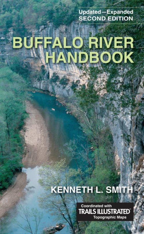 The highly anticipated second edition of the Buffalo River Handbook, written by Kenneth L. Smith, updates and expands the first edition initially published in 2004. The new edition includes the recently completed 28-mile segment of the Buffalo River Trail from U.S. Hwy 65 (Grinder’s Ferry) to AR Hwy 14 (Dillard’s Ferry) along the Buffalo National River in north Arkansas. Updates and revisions throughout the book describe the current setting with respect to campsite information and amenities, status of historic structures, and geologic conditions of the river and trails. Ken Smith—conservationist, park planner, and the designer and construction supervisor of most of the eighty miles of the Buffalo River Trail—brings to light in this edition his discerning engineer’s intellect, his photographer’s eye, his love for the outdoors as well as the people and land of the Ozarks and the Buffalo National River, and his passion for the protection and active exploration of our natural resources. An inductee into the Arkansas Tourism Hall of Fame in 2017 for his conservation efforts, Smith offers a three-part guide to the river, complete with maps, diagrams and photographs: insights on geology, wildlife, plants, Native Americans, pioneers, and the history of the development of the Buffalo River as the first National river; a detailed guide describing the entire 146-mile length of the river itself; and a guide for over 150 miles of hiking trails. The Buffalo River Handbook, 2nd edition, is a comprehensive reference encyclopedia, a trail and float guide, and a cultural history of the area of north Arkansas that encompasses the Buffalo River—a jewel in the crown of undammed, free-flowing rivers in Arkansas and the nation.
 -
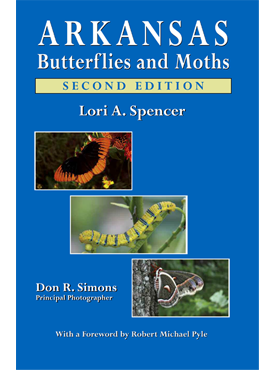
Arkansas Butterflies and Moths, 2nd edition, includes 264 species of butterflies and moths found in Arkansas. Species identification is facilitated through detailed text entries alongside 300 full-sized color photographs. And, for the first time ever, all butterfly species in the state are included. Many live photographs and shots of larvae are used, and butterfly gardening and prime butterfly-watching locations in the state are covered.
-

This beautiful color illustrated book provides a clear, concise way for children to identify Arkansas’s state butterfly, the Diana Fritillary, in its natural habitat by Lori A. Spencer. It features 28 color photographs, drawings, and other resources for children, parents, and social studies teachers.
-
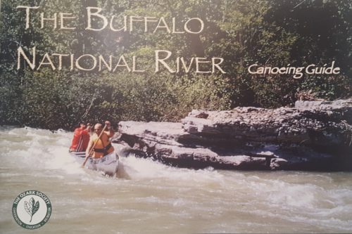 Complete revision of The Buffalo National River Canoeing Guide, this is the 4th revised edition of this classic guide, done by members of the Ozark Society, dedicated to Harold and Margaret Hedges. This guide includes all aspects of the Buffalo River experience, including safety tips, equestrian trails, the GPS Coordinates for points along the river, and topographic maps and narrative river logs.
 -
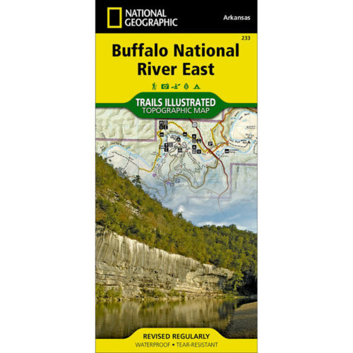
This map, first published by Trails Illustrated in 1992-93, uses USGS topographic maps as a base. T.I. has added hiking and horse trails, roads, campgrounds, and other features not shown on the 1960s vintage USGS maps. Also shown are routes of access to river and wilderness, and floaters’ car shuttle routes. Map users will find it easy to calculate the mileage of any trail hike or river trip and will see information for hikers, floaters, horseback riders, for anyone wanting to explore the Buffalo. The map is printed in four colors on waterproof, tear-proof plastic. Map design and text are by Ken Smith, author of Buffalo River Handbook and The Buffalo River Country, with cooperation from the National Park Service and U.S. Forest Service. This map includes the Leatherwood and Lower Buffalo Wilderness Areas. -
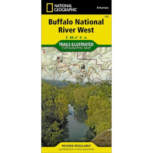
This map, first published by Trails Illustrated in 1992-93, uses USGS topographic maps as a base. T.I. has added hiking and horse trails, roads, campgrounds and other features not shown on the 1960s vintage USGS maps. The map includes routes of access to river and wilderness, and floaters’ car shuttle routes, and map users will find it easy to calculate the mileage of any trail hike or river trip. Included is a list of day hikes graded by difficulty and information for hikers, floaters, horseback riders, for anyone wanting to explore the Buffalo. This map is printed in four colors on waterproof, tear-proof plastic. Map design and text are by Ken Smith, author of Buffalo River Handbook and The Buffalo River Country, with cooperation from the National Park Service and U.S. Forest Service. -
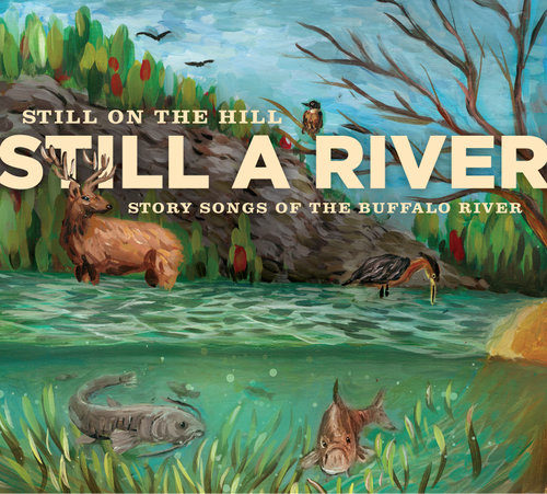 Still on the Hill builds on their reputation as ‘ambassadors of the Ozarks’ with this collection of story songs of the Buffalo River. The river was scheduled to be dammed in the late 60s but a state-wide uprising prevented this fate and it became our nation’s first historic river--a National Park to flow free for all time. Still a River celebrates this pristine river and its rich treasure trove of stories in the form of song. This folk duo comprised of Kelly and Donna Mulhollan have deep Ozark roots and both are powerful instrumentalists, vocalists, and songwriters. They have been recognized by the State of Arkansas for their work and received the Governor’s Folk Life Award in 2009. This project was funded by the Buffalo River Watershed Alliance, the Ozark Society, and the community of NW Arkansas. Release Date: 2016
 -
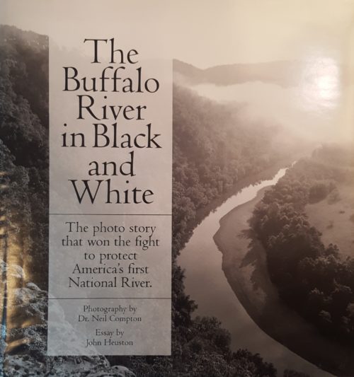 These wonderfully detailed and beautifully printed photographs are about people's adventures and discoveries: The Buffalo River and its towering bluffs, its side canyons with hidden waterfalls, its natural bridges, historic places, and more. For those who have been there, the book brings great memories. Been there or not, it can inspire you to learn more. In his essay, John Heuston tells how these photographs became powerful weapons in historic battles to keep the Buffalo River and other wonders from being spoiled. The book’s nearly 100 photographs are reproduced by the same duotone process employed for the finest books of photographic art. 96 pages, hardbound, 9½ x 10.
 -
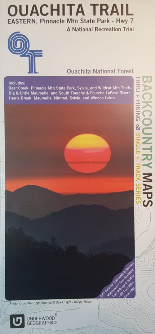 This is a beautiful, descriptive map of the eastern portion of the Ouachita Trail completed by Underwood Graphics. The map covers the Ouachita Trail from Pinnacle Mountain State Park to Highway 7 and includes: Bear Creek, Pinnacle Mountain State Park, Sylvia, and Wildcat Mountain Trails. The map depicts the following rivers: Big and Little Maumelle, South Fourche, and Fourche LaFave. Harris Break, Maumelle, Minrod, Sylvia, and Winona Lakes are also shown.
 -
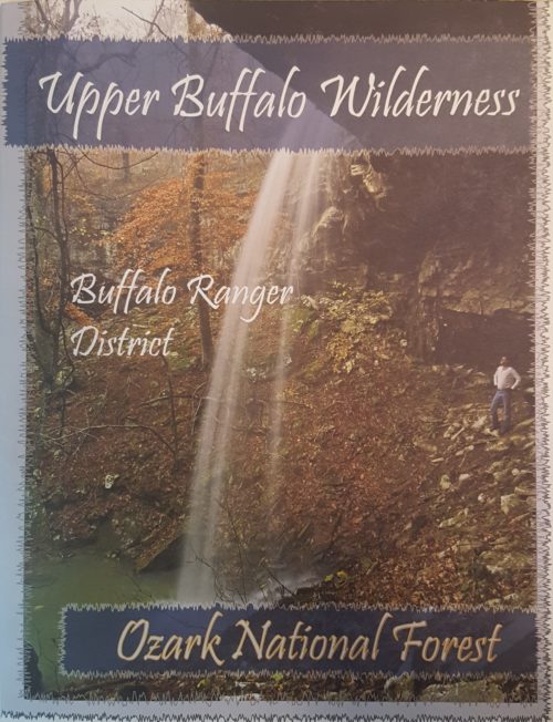 The Ozark Society, in cooperation with the U.S. Forest Service, has produced a series of new Arkansas Wilderness maps. These GPS friendly maps use UTM grids and the standard topo scale of 1:24,000. The Ozark Highland Trail and private inholdings are very clearly marked and valuable contact information and Leave No Trace camping tips are included. The maps feature the photography of Tim Ernst. For the first time, an entire wilderness area can be viewed on one map.
 -
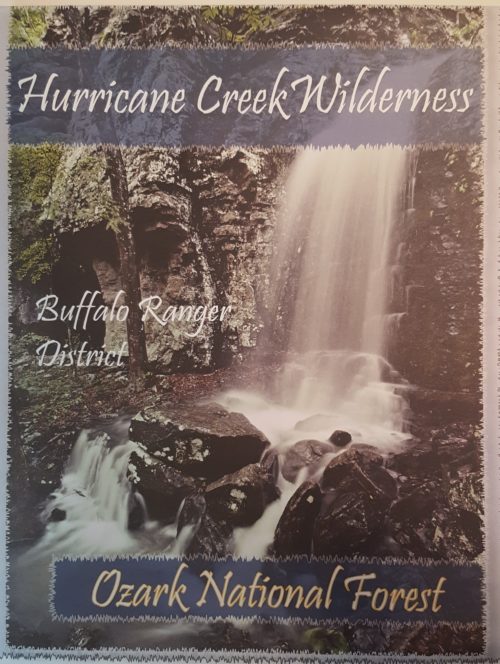 The Ozark Society, in cooperation with the U.S. Forest Service, has produced a series of new Arkansas Wilderness maps. These GPS friendly maps use UTM grids and the standard topo scale of 1:24,000. The Ozark Highland Trail and private inholdings are very clearly marked and valuable contact information and Leave No Trace camping tips are included. The maps feature the photography of Tim Ernst. For the first time, an entire wilderness area can be viewed on one map.