-
 Douglas W. Tallamy says, "The wisdom Loring Bullard shares in An Environmental Journey is relevant far beyond the boundaries of Missouri. It is a message people everywhere can and must address." Price $30.00 ISBN: 979-8-218-44274-3
 -
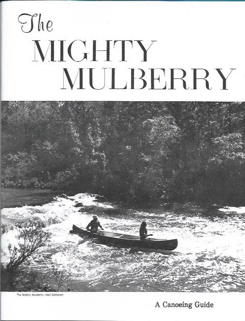 The Mighty Mulberry is a “nostalgia” item originally printed in 1974. It has wonderful photos of many of the Ozark Society founding members, including authors Harold and Margaret Hedges running Sacroiliac in their aluminum canoe. The center is one of the best maps of the Mulberry ever produced containing all of the rapids under their original names. This booklet has been faithfully reprinted on fresh, crisp print stock. Enjoy a new copy of this classic Ozark Society publication. Quantities limited. $10.00
 -
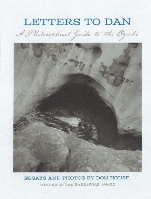 Letters To Dan: A Philosophical Guide to the Ozarks, written by Don House, is a series of essays and photos about the Ozark Mountains of Arkansas. It is the winner of the Ozark Society Sassafras Award in Literature. The guideposts for this journey are the region's rivers and hills, it's forests and vibrant wildflowers. In personal essays and photographs, Don House describes old cemeteries, abandoned buildings, and highway memorial crosses. He introduces us to a neighbor skilled at dowsing, to local cafe owners and river guides. The essays express a love of the region's heritage and it's modern culture. The book creates a sense of place and shows us how to live in harmony with the natural world. $20.00 ISBN 978-0-912456-12-6
 -
Out of stock
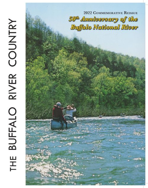 Kenneth L. Smith Edited by Janet Parsch This 2022 Commemorative Reissue of The Buffalo River Country includes…
- A Foreword by Suzie Liles and Jim Liles, National Park Service (retired)
- The complete text from the 3rd edition (1976)
- “Past and Future” -- The revised chapter from the three editions in 1967, 1970, and 1976 describes the status and progress on the legislation that created the Buffalo National River in 1972
- 13 maps and 150 photos
-
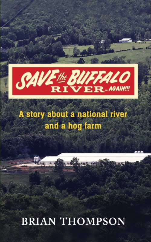 "A massive industrial hog operation is quietly permitted and constructed near the Buffalo National River, the pristine crown jewel of the state of Arkansas. It is nearly complete by the time the public becomes aware of it, too late to do anything to stop it. This is the true story of how a small group of Arkansans stood toe to toe with powerful special interests, state and federal agencies, the state legislature, and two of the largest corporations in the world, all to protect the Buffalo National River for future generations. Ignored and disparaged, they lost every step of the way. ...Until they won." Save the Buffalo River Again by Brian Thompson $16.95
 -
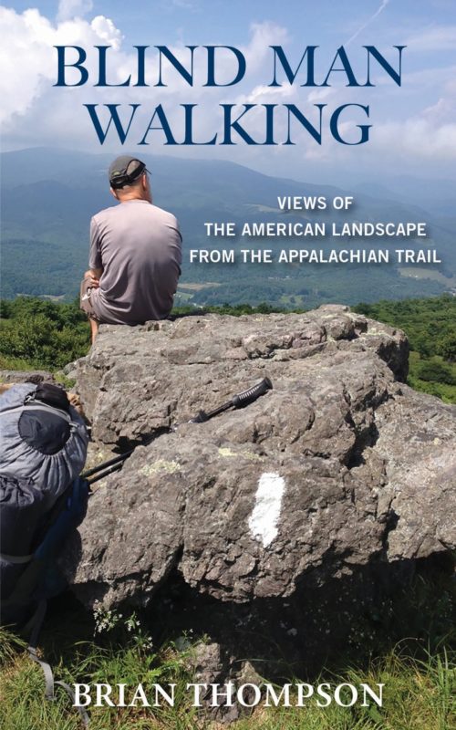 Two old college buddies contemplate hiking the Appalachian Trail. The problem is, one of them is severely vision impaired and his ability to follow a simple footpath is in serious question. They decide to first try an overnight hike in Arkansas; an unmitigated disaster. Upon their return, one fellow's wife declares he is too old fat and blind to be crashing about in the woods. The other’s wife notes how lucky they are to have learned their lesson before attempting anything as seriously challenging as the Appalachian Trail. Humiliated, their dignity in tatters, (and perhaps not the fastest learners), they decide to go anyway. This is their story, traveling America’s greatest footpath; the places, the people, the history. ISBN: 979-8577057978, 276 pages, paperback, February 2021
 -
 ISBN: 978-0-9982807-7-6
 -
 ISBN: 978-0-9982807-6-9
 -
 ISBN: 978-0-9982807-8-3
 -
ORDER NOW!
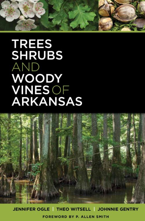
This attractive, heavily illustrated field guide is the most comprehensive accounting of the woody plants of Arkansas ever published. The book will be a valuable companion for all who appreciate Arkansas flora in rural, urban, and wilderness areas. You will want to have a copy in your backpack as well as on your bookshelf. P. Allen Smith says, "This is a colossal body of work that will inform and benefit many, enthusiasts and professionals alike, for decades to come." Dr. Gary Tucker says, "What a great job you guys have done on the book. A much-needed publication that is well written..." -
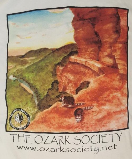
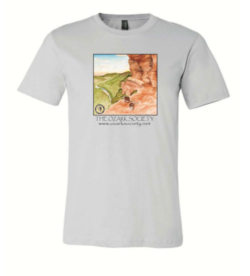
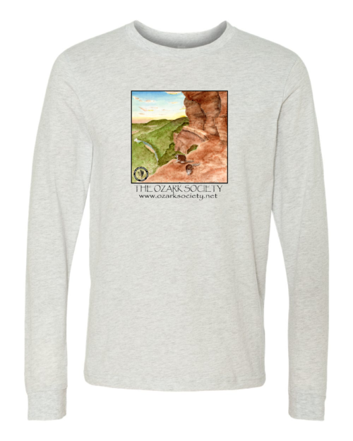
 Represent the Ozark Society with this small metal pin!
 -
 This patch has an adhesive back and can be ironed on or sewn on.
 -
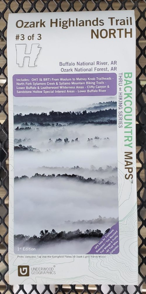
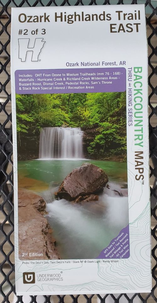
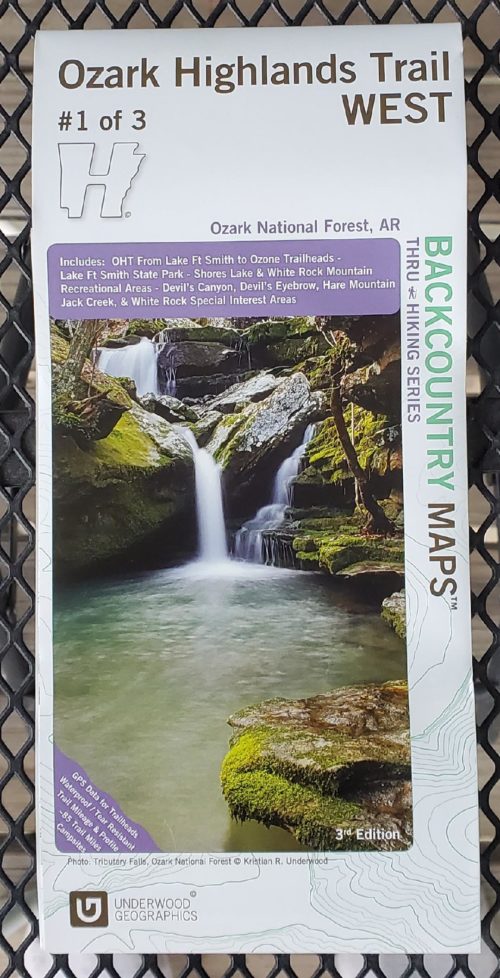
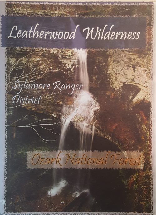
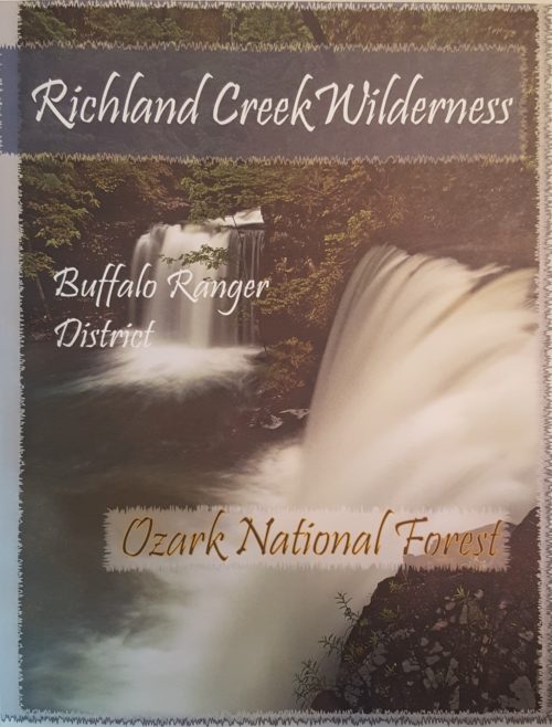
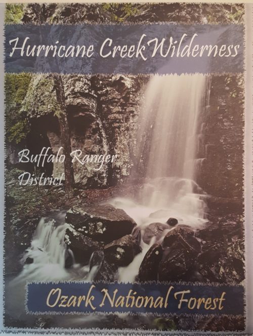
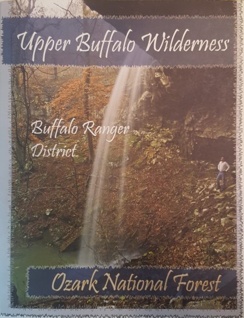
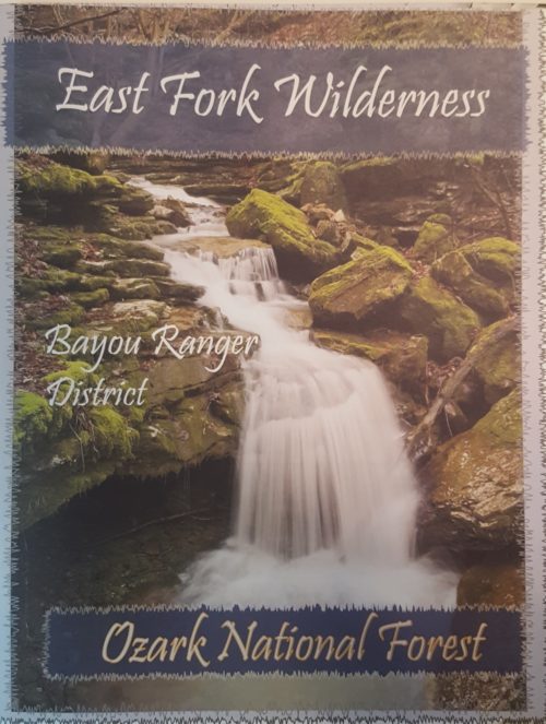 The Ozark Society, in cooperation with the U.S. Forest Service, has produced a series of new Arkansas Wilderness maps. These GPS friendly maps use UTM grids and the standard topo scale of 1:24,000. The Ozark Highland Trail and private inholdings are very clearly marked and valuable contact information and Leave No Trace camping tips are included. The maps feature the photography of Tim Ernst. For the first time, an entire wilderness area can be viewed on one map.
 -
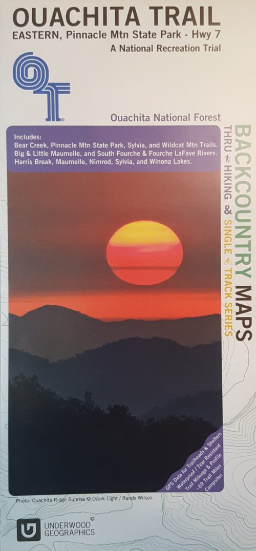 This is a beautiful, descriptive map of the eastern portion of the Ouachita Trail completed by Underwood Graphics. The map covers the Ouachita Trail from Pinnacle Mountain State Park to Highway 7 and includes: Bear Creek, Pinnacle Mountain State Park, Sylvia, and Wildcat Mountain Trails. The map depicts the following rivers: Big and Little Maumelle, South Fourche, and Fourche LaFave. Harris Break, Maumelle, Minrod, Sylvia, and Winona Lakes are also shown.
 -
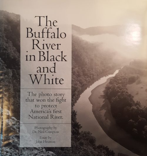 These wonderfully detailed and beautifully printed photographs are about people's adventures and discoveries: The Buffalo River and its towering bluffs, its side canyons with hidden waterfalls, its natural bridges, historic places, and more. For those who have been there, the book brings great memories. Been there or not, it can inspire you to learn more. In his essay, John Heuston tells how these photographs became powerful weapons in historic battles to keep the Buffalo River and other wonders from being spoiled. The book’s nearly 100 photographs are reproduced by the same duotone process employed for the finest books of photographic art. 96 pages, hardbound, 9½ x 10.
 -
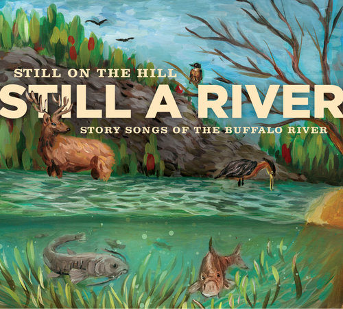 Still on the Hill builds on their reputation as ‘ambassadors of the Ozarks’ with this collection of story songs of the Buffalo River. The river was scheduled to be dammed in the late 60s but a state-wide uprising prevented this fate and it became our nation’s first historic river--a National Park to flow free for all time. Still a River celebrates this pristine river and its rich treasure trove of stories in the form of song. This folk duo comprised of Kelly and Donna Mulhollan have deep Ozark roots and both are powerful instrumentalists, vocalists, and songwriters. They have been recognized by the State of Arkansas for their work and received the Governor’s Folk Life Award in 2009. This project was funded by the Buffalo River Watershed Alliance, the Ozark Society, and the community of NW Arkansas. Release Date: 2016
 -
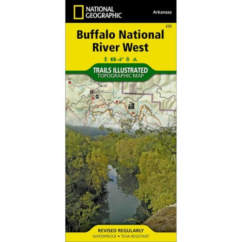
This map, first published by Trails Illustrated in 1992-93, uses USGS topographic maps as a base. T.I. has added hiking and horse trails, roads, campgrounds and other features not shown on the 1960s vintage USGS maps. The map includes routes of access to river and wilderness, and floaters’ car shuttle routes, and map users will find it easy to calculate the mileage of any trail hike or river trip. Included is a list of day hikes graded by difficulty and information for hikers, floaters, horseback riders, for anyone wanting to explore the Buffalo. This map is printed in four colors on waterproof, tear-proof plastic. Map design and text are by Ken Smith, author of Buffalo River Handbook and The Buffalo River Country, with cooperation from the National Park Service and U.S. Forest Service.